


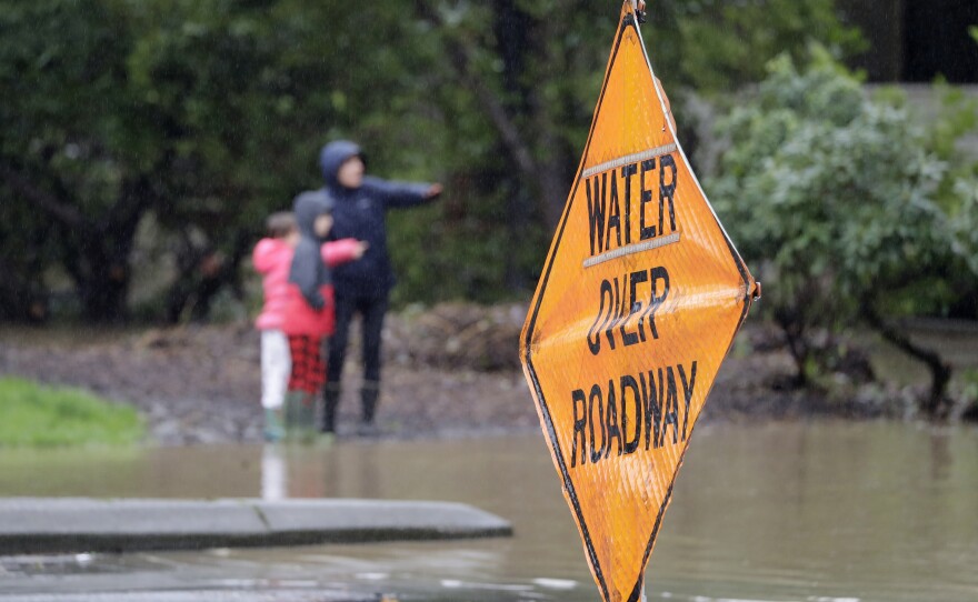


A flood watch continues till 4 o'clock Friday. The National Weather Service says although the rain had tapered down earlier in the morning and most area rivers were expected to crest in the afternoon, flooding will continue into Saturday.
Eleven people were evacuated from an apartment complex in Issaquah Thursday, with standing water causing road closures all around the region.
This kind of flooding does happen regularly in western Washington, especially in areas that are connected to rivers that drain off the Cascade Mountains.
But KNKX weather expert Cliff Mass says the rainfall people have experienced here this week has been exceptionally intense. It’s because of the angle at which the atmospheric river that’s causing the precipitation has come in.
NOT THE NORM
“Something unusual has been going on the last few days,” says Mass. ”We’ve had an atmospheric river… but instead of coming from the normal direction, from the south or southwest, it came out of the west to northwest.”
As a result, this westerly flow is pushing the moisture into the Cascade Mountains, pretty much perpendicular to the range.
“That has a big impact on the mountains,” Mass says. “It maximizes the upslope flow on the western side of the Cascades, which results in substantial precipitation from just east of Puget Sound – and that’s exactly what happened.”
The angle also maximizes the rain shadow effect from the Olympic Mountains, with areas around greater Seattle getting doused, while those tucked beneath the lee side of that range get far less.
“We’ve had a tremendous amount of rain the last three days,” Mass says. “Some places on the western side of the Cascades have gotten five to ten inches of rain, while if you’re in the rain shadow of the Olympics, there was only an inch or maybe an inch and a half. – huge contrast.”
CLIFF’S FORECAST
FRIDAY: the big threat, Friday evening, Mass says, will be wind.
“A very strong, tight low-pressure center is going to be moving north of us. So, sometime after dinner, the winds are going to pick up and I expect overnight, here in Puget Sound, the winds will gust up to 30 to 50 miles per hour in exposed places.
He says there’s potential for power outages, especially since the soils are so saturated, making it easier for trees to fall.
SATURDAY: a transitional day as the low-pressure center moves past and winds back off …with some showers and temps falling, from a high of about 50 Friday to 47-48 Saturday. Snow in the mountains, with 6-12 inches in the passes.
SUNDAY: Mostly dry, temps in upper 40s, sun likely.
Monday-Tuesday: dry.
Weather with Cliff Mass airs at 9:02 a.m. Friday, right after BirdNote, and twice on Friday afternoons during All Things Considered. The feature is hosted by KNKX environment reporter Bellamy Pailthorp. Cliff Mass is a University of Washington professor of atmospheric sciences, a renowned Seattle weather prognosticator, and a popular weather blogger. You can also subscribe to podcasts of Weather with Cliff Mass shows, via iTunes or Google Play.
